The below article is part of the series “Seizing Lebanon’s Moment,” a joint initiative with the Italian Institute for International Political Studies (ISPI). The contributors to this series — who comprise top scholars, policymakers, and professionals from Lebanon, Europe, and the United States — set out to identify Lebanon’s critical problems and propose specific reforms aimed at practitioners and officials dedicated to helping the country recover from its deep, multi-year crisis. The series has been compiled in a report, whose findings aim to carry forward the constructive policy dialogue initiated during this year’s Mediterranean Dialogues Conference.
The central challenge facing Lebanon today is whether the country will graduate to functional statehood or continue struggling to survive. The sectarianism and feudalism of Lebanon’s Ottoman past endure in today’s confessionalism, clientelism, and localism. Yet with Lebanese officials now insisting that the state “monopolize arms” and become the decisive arbiter on matters of war and peace, a relevant question arises: Where, territorially, does Lebanon begin and end?
The answer to this question bears heavily on the ability of the Lebanese to vest decisive political power in a state representing all citizens — a state with secure and recognized borders within which the government of Lebanon truly governs. Undefined and unstable borders keep Lebanon on the brink of collapse.
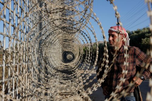
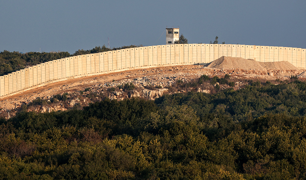
Clearly, the line currently dividing Lebanon from Israel and Israeli-occupied territory entails disputes that enabled a powerful Lebanese militia serving as Iran’s proxy to gratuitously prolong, with catastrophic consequences, an armed conflict with Israel long after the end of its occupation of southern Lebanon in 2000.
Clearly, a largely un-demarcated boundary with Syria in Lebanon’s east promotes the destructively destabilizing aims of malign external actors, terrorists, drug dealers, and smugglers. It also reminds many Lebanese — and Syrians as well — that Syria never fully reconciled itself to Lebanon’s independence.
So: Where does Lebanon begin and end? And in areas where the “end” is in dispute, how might such disputes be resolved?
Demarcating Lebanon
Lebanon began with Mount Lebanon, an autonomous Ottoman jurisdiction during the empire’s dying days. In 1920, France created “Grand Liban” by attaching to Mount Lebanon coastal cities running from Tripoli to Tyre. It also added the northern Akkar region, Jabal ‘Amil in the south, and the Beqaa Valley east of the Lebanese Mountains. France’s goal was to create the largest possible jurisdiction containing a Christian majority, people who France erroneously thought would always uphold its Levantine imperium. That majority, along with French rule, is long gone.
As the League of Nations-designed mandatory power in Lebanon and Syria, France proved largely uninterested in clearly defining where Syria ended and Lebanon began. In Lebanon’s north, the Nahr al-Kabir waterway provided an obvious boundary. But the rest — lines on a map running through lightly populated areas down the eastern Biqa’, into the Arqub, and up onto the slopes of Mount Hermon — never inspired Paris to undertake the kind of rigorous surveying and marking exercise it undertook with London while separating Palestine from Lebanon and Syria. In that case, two army officers — a Frenchman named Paulet and a Brit named Newcombe — surveyed and marked a line running from near the Mediterranean Sea all the way to al-Hammah (today’s Hamat Gader) near Tiberias.
The two surveyors produced in 1923 what was — for a quarter century — the “international boundary” separating Palestine from Lebanon and Syria. In 1949, the northern section of that border became the armistice line between Israeli and Lebanese military forces. Between 1949 and 1951, the line was re-demarcated under United Nations supervision. From 1949 through the June 1967 Six-Day War, Israel and Lebanon kept the peace along the unfenced line.
The war of 1967, however, changed the Lebanon-Israel relationship dramatically. Lebanon was not a combatant. But Israel, having taken East Jerusalem, the West Bank, the Golan Heights, and the Sinai Peninsula from its Arab neighbors, thereby voiding armistices with Jordan, Syria, and Egypt, also renounced the armistice with Lebanon. And even as the line dividing Lebanese and Israeli forces was extended up along the Golan Heights, Lebanon was losing control of its southern districts to armed Palestinian groups. After the Israeli invasion of 1982, Palestinian fighters would be replaced by Iran’s Lebanese proxy militia — Hizballah — also fighting Israel. Although the powerless Lebanese government continued to uphold the existence of the 1949 armistice, it was operationally a dead letter in an era of cross-border violence and Israeli occupation.
Borders and occupation
As the end of Israel’s occupation of southern Lebanon approached in 1999, Hizballah became alarmed that its legitimizing status as Lebanon’s “Resistance” might end along with the occupation. But how to square Israel’s retreat with alleged ongoing occupation? Hizballah first induced the government of Lebanon to claim seven onetime Palestinian villages in Israel, places populated until 1948 by Shi’a Muslims. Yet the preposterousness of the claim made it unsustainable. It was replaced by an assertion of Lebanese sovereignty over a small (about 30 square kilometers) mountainside strip of the occupied Golan Heights: pastures known as the “Shebaa Farms” and adjoining acreage called the “Kfar Shouba Hills.”
Plots of land in this elevated sector of the Golan were indeed owned by people from the Lebanese villages of Shebaa and Kfar Shouba. France, however, had drawn a map line placing the acreage in Syria. Before 1967, Lebanon and Syria held talks on Lebanon’s desire to exercise jurisdiction over the area. Reportedly, the two countries reached a working-level agreement to do so. But that agreement was never translated into a formal boundary adjustment. Still, Lebanon never accused Syria of occupying Lebanese land.
Indeed, when Israel occupied the farms and the hills after June 1967, there was still no outcry from Beirut over Lebanese land being seized. Until 2000, when Israel unilaterally withdrew from southern Lebanon, the Lebanese government never demanded that the farms and hills be patrolled by the UN Interim Force in Lebanon (UNIFIL). Lebanon knew quite well that Syria had never transferred the land before it was occupied by Israel.
Eager to keep Hizballah in the business of armed resistance, in 2000, Syria endorsed Lebanon’s abrupt claim of Israeli occupation in a telephone call from the foreign minister to the UN secretary-general. But the “Blue Line” — drawn by the UN with the input of both sides to confirm Israel’s withdrawal from Lebanon — kept the farms and the hills inside the Israeli-occupied Golan Heights. The cartographic justification for doing so was compelling. And in 2011, then-Syrian President Bashar al-Assad affirmed to the author that the territory in question is Syrian; Syria would be willing to discuss changing its status with Lebanon, he added, but only after the Israeli occupation ended.
The tripartite nature of this dispute obviously makes its near-term settlement problematic. Still, Lebanon and Syria could address the matter in their recently established joint boundary commission. Syria could either reassert its sovereignty or formally convey the farms and hills to Lebanon. If Damascus maintains the position that the land is Syrian, Beirut could either accept or reject its neighbor’s assertion. Or the parties might agree to defer a decision until the end of Israeli occupation. Indeed, it is no small detail that Israel annexed the farms and hills as part of the Golan Heights and is militarily in control.
Still, nothing (other than a revived Hizballah) would prevent Lebanon and Israel from respecting the inviolability of the Blue Line in the affected area, perhaps pursuant to an updated armistice. The ultimate disposition of these windswept tracts can easily await formal peace talks between Israel and its two neighbors.
Where is here?
The other Blue Line dispute involving territory occupied by Israel in 1967 involves the village of Ghajar, a jurisdiction administered by Israel despite the Blue Line placing its northern precinct — up to two-thirds of the village — inside Lebanon.
There is controversy over the cartographic and expansionist roots of this anomaly. When Israeli forces entered the Golan in June 1967, they did not initially occupy Ghajar, thinking it was (based on a British map derived from French cartography) Lebanese territory. Ghajar, however, was Syrian. Some analysts maintain, therefore, that the Blue Line bisection of Ghajar is the fatally flawed product of faulty Anglo-French cartography. Others, however, believe that post-1967 Ghajar expanded its footprint into Lebanese territory and that the Blue Line delineation is correct, notwithstanding a legacy of cartographic errors.
Surely a solution to the Ghajar dispute must accommodate the desires of Ghajar’s people. Lebanon knows that no Lebanese reside in Ghajar and that none of the village’s residents want to become Lebanese. Still, the Blue Line places part of it inside Lebanon.
Lebanon could consider adjusting the Blue Line (which is not an international boundary) in return for Israeli concessions, territorial and otherwise. If, however, the Blue Line remains as it is, perhaps they could agree that Ghajar will operate as a unified entity with its citizens free to cross the invisible Blue Line within the village, with the Israel Defense Forces (IDF) staying south of the Line, and with Lebanon establishing a modest official presence north of it. Lebanon and Israel might also consider, perhaps in an annex to an updated armistice, forming a joint coordinating body to ensure the smooth functioning of a jurisdiction bisected by a line on a map.
The politics of delineation
There are also several disputed points along the 1923 international boundary/1949 armistice demarcation line. They involve discrepancies between the Blue Line and its cartographic predecessors. One suggests that an Israeli kibbutz (Misgav Am) expanded during Israel’s occupation at the expense of the Lebanese village of Odaisseh, now lying in ruins. In 2000, the chief cartographer of the UN emphasized that although his surveyors did their best to take the 1950 UN delineation of the armistice demarcation line into account, the Blue Line does indeed reflect some “practical” deviations. Given uncertainty about the exact trace of the 1923/1949 line, perhaps the parties can demonstrate confidence-building flexibility in settling the remaining disputes.
The key point, however, is that Lebanon’s emergence as a functioning state will require a permanent end to hostility with Israel, a conflict that has divided the Lebanese, all-but-destroyed parts of the country, and now contributes to obstructing reconstruction and reform. For this exit to happen, territorial grievances must be resolved or mitigated and an armistice regulating bilateral security relations achieved.
A similar point may be made in connection with the Syria-Lebanon boundary in Biqa’ and Arqub. As noted above, an array of destabilizing actors takes full advantage of border ambiguities, raising the possibility of armed confrontation between the security forces of the two countries.
Resolution will require tradeoffs
The US — perhaps with the assistance of Saudi Arabia, the United Kingdom, France, and others — could help the parties demarcate and secure their common boundary. The State Department’s Office of the Geographer and Global Issues can weigh in with a comprehensive study of the boundary’s cartographic evolution, and US diplomats with partners can provide mediation services as needed. France has provided Lebanon with important archival materials. What is important, however, is for the Syria-Lebanon boundary commission to convene soon and launch the demarcation process.
It is likely that evidence collected on the boundary’s trace will depict lines running through populated areas and into difficult, even impassable terrain. Flexible tradeoffs will be required. With the assistance of the UK, Lebanon has made great progress in monitoring and securing stretches of the Lebanon-Syria frontier. Syria may need considerable technical assistance to match Lebanon’s equipment and expertise. It is in the interests of both to ensure that a porous, ill-defined boundary is rectified and secured to the point where malign outside political actors (Iran, Islamic State, etc.), terrorists, drug smugglers, and common criminals find cross-border operations difficult or impossible.
Over the past half-century, Lebanon has imploded politically and economically. It has been a battlefield dominated by outsiders. An opportunity, albeit fleeting, now exists to build a state. Where Lebanon began territorially is clear from history. Where it ends remains to be seen. What is required to define and to secure borders is political will, creative diplomacy, and hard work. Otherwise, a country plagued with disputed boundaries may, in the end, prove unable to graduate to statehood, stability, reconstruction, and peace.
Ambassador Frederic C. Hof is a Senior Fellow at the Bard College Center for Civic Engagement. His latest book is Reaching for the Heights: The Inside Story of a Secret Attempt to Reach a Syrian-Israeli Peace (2022).
Photo by Christina Assi/AFP via Getty Image
The Middle East Institute (MEI) is an independent, non-partisan, not-for-profit, educational organization. It does not engage in advocacy and its scholars’ opinions are their own. MEI welcomes financial donations, but retains sole editorial control over its work and its publications reflect only the authors’ views. For a listing of MEI donors, please click here.