With Israel and Hezbollah on the brink of war following Hamas’ Oct. 7 massacre and Israel’s subsequent devastating assault on the Gaza Strip, there have been ongoing diplomatic attempts to defuse tensions along the Israel-Lebanon border. At the center of these efforts lies an American proposal according to which, in exchange for Hezbollah’s retreat to the north beyond the Litani River (in compliance with the 2006 UN Resolution 1701), Israel would agree to address Lebanon’s grievances about alleged violations of its sovereignty in sites along their shared boundary. Thirteen of these sites are located along the boundary that separated mandatory Palestine from mandatory Lebanon, from Rosh Ha-Nikra/Ras al-Naqoura on the Mediterranean coast in the west to the Roman or Ghajar Bridge in the east, four kilometers south of the village of Ghajar, the historic tri-border point between Israel/Palestine, Lebanon, and Syria. Following the 1948 war, this boundary was designated as the armistice line between Lebanon and Israel. The remaining territorial sites of contention are stretched along the (unmarked) Syrian-Lebanese boundary, which since the 1967 war has been between Israeli-occupied Golan Heights and Lebanon. This is where the village of Ghajar is located as well as the area that, as of May 2000, has been called in Lebanon “the Shebaa Farms” and that in Israel is known as Mount Dov, or the Sion Mountain range up to the Mount Hermon crest. In June 2000, following the Israeli pullout from South Lebanon, the UN demarcated the Israeli line of withdrawal, or the Blue Line, along both sections of the boundary for the purpose of confirming its completion without prejudging the exact location of the international boundary between the two states.
In a different political climate, addressing the 13 sites along the Israel-Lebanon border claimed by Beirut from Rosh Ha-Nikra/Ras al-Naqoura to the Roman Bridge would not be an insurmountable obstacle for an unbiased boundary arbitration committee to overcome. Most of these sites are territorially small and even the contested area in Rosh Hanikra/Ras al-Naqoura, which is the most consequential given its potential impact on the course of the maritime boundary, could be addressed and resolved if Lebanon and Israel ever signed a peace agreement of their own goodwill that included finalizing their shared boundary.
The bigger challenge involves the portion of the boundary from the Roman Bridge to the Mount Hermon range for three main reasons: First, it is tied to Israeli control of the Golan Heights and requires the participation of Syria in any negotiated agreement on the location of the boundary line. Second, there is no reliable treaty or map that could be used as the foundation for sorting out sovereignty issues in this area since Syria and Lebanon never reached an agreement over the location of their shared boundary. And third, this area, and in particular the Shebaa Farms, has become the symbol of Hezbollah’s struggle against Israel and, unless Israel hands over this territory to Lebanon unconditionally, it is unlikely that Hezbollah would agree to “resolve” it as doing so would take away its most important raison d’être.
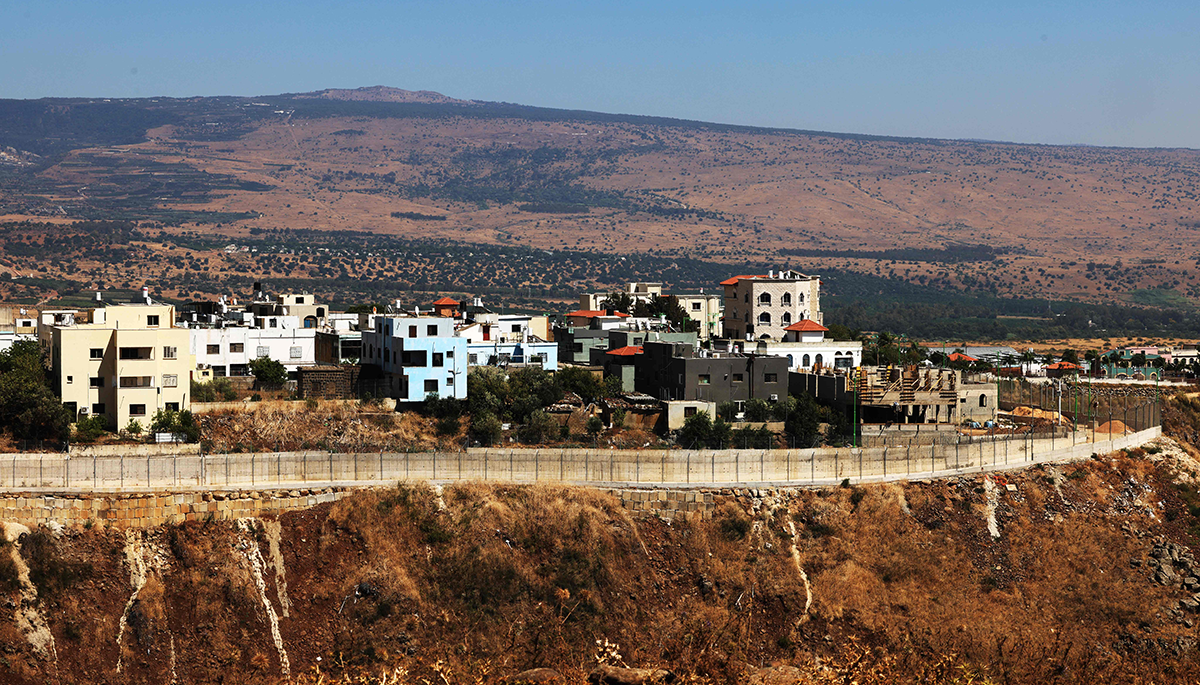
The village of Ghajar at the center of the tension
Of the entire 15 points of contention, the village of Ghajar stands out as a result of the humanitarian crisis created by the June 2000 demarcation of the Blue Line that led to its partition. As I demonstrated in detail elsewhere, the partition of the village was an error made by the UN whose roots lie in political and cartographic irregularities going back to the French mandate over Syria and Lebanon. France, the colonial power that controlled Syria and Lebanon, never demarcated their shared boundary and never completed an authoritative cartographic project to map Syria and Lebanon. Maps produced by France and Britain from the 1930s on placed the village at times in Lebanon and at other times in Syria. With Lebanon and Syria gaining independence in 1943 and 1946 respectively, both countries inherited and perpetuated these cartographic irregularities as, for political reasons, they never completed a precise boundary demarcation procedure followed by a boundary treaty. Still, Ghajar, for all legal and practical matters, was a Syrian village, recognized by the governments of both Syria and Lebanon as such, despite the fact that from the mid-1940s on, most maps placed it inside Lebanon.
A twist in the cartographic story of the village took place between 1963 and 1966, when for the first time Lebanon began producing maps that showed Ghajar partitioned by a boundary line, leaving its northern neighborhood in Lebanon and keeping its southern neighborhood inside Syria. Furthermore, these new maps gave the northern neighborhood of Ghajar a new name — al-Wazzani — creating the false impression that it was a separate village. The reason for this entirely new, invented version of the boundary is likely tied to the fact that in 1963 Lebanon and Syria formed a committee to negotiate the management of their three shared rivers: Nahr al-Kalb in the north, al-‘Assi (Orontes) in northeast, and the Hasbani in the south — which runs exactly along their shared boundary next to Ghajar. By drawing a new boundary line in this 1963 map that partitioned Ghajar, the Lebanese were able to demonstrate — at least cartographically — that al-Wazzani spring, the most abundant spring of the Hasbani river, just below the village of Ghajar, is squarely inside Lebanon and thus did not need to be shared with Syria.
Perhaps because of its quality, this new map spread like wildfire. Israel, Syria, the UN, and others copied and began using its boundary version, thus spreading the mistake cartographically and eventually also politically. For example, soon after Israel occupied Ghajar together with the Golan Heights following the June 1967 war, it began producing new maps of the Golan Heights that adopted the version of the 1963 Lebanese map, despite the fact that it occupied the entire village and that in early 1982 even gave all of its residents Israeli citizenship. UN maps also adopted this newly invented version, which was sanctioned by the Syrian, Lebanese, and Israeli governments, as demonstrated in the 1974 UN Disengagement Observer Force (UNDOF) and 1978 United Nations Interim Force In Lebanon (UNIFIL) maps for South Lebanon and the Golan Heights, respectively.
The partition of the village in 2000
From 1967 to 2000, the villagers, however, continued to live their lives uninterruptedly as one single community. The entire village was under Israeli control and the villagers were oblivious to the fact that maps, even Israeli maps, falsely named their northern neighborhood al-Wazzani and placed it inside Lebanon. This all changed in May 2000, following the Israeli withdrawal from South Lebanon. Entrusted with the mission to determine the Israeli line of withdrawal, UN cartographers resorted to the available documentation they could find to carry out their work. In the absence of a Syrian-Lebanese boundary treaty, they used UN maps that relied on the 1963 Lebanese map, showing the two neighborhoods of Ghajar as two separate villages: a southern one under the Israeli-controlled Golan Heights, called Ghajar, and a northern one, under Lebanese sovereignty, called al-Wazzani. And so, the UN cartographic team decided to partition Ghajar. Interestingly, a cursory look at Ghajar in Google Maps will show that this mistake is still perpetuated to the present.
The villagers refused to accept the partition of the village and from 2000 until 2006 a unique anomaly was created along the Blue Line where Ghajar became the only porous space in an otherwise tightly secured Israeli-Lebanese boundary. Israeli soldiers were stationed in the southern neighborhood of the village and Hezbollah militiamen had free access to its northern neighborhood, which became part of Lebanon. This anomaly was further exacerbated by the fact that now, citizens of Israel, as Ghajar residents are, lived inside Lebanese territory and mingled with Hezbollah militiamen and other Lebanese citizens.
From the 2006 summer war on
Hezbollah took advantage of this reality and attempted but failed to abduct Israeli soldiers from the southern part of Ghajar. Following the 2006 summer war between Israel and Hezbollah, Israel ended this anomaly and re-occupied the northern part of the village. By doing so, it resolved its own security dilemma and eased the villagers’ humanitarian crisis but created a new challenge by infringing on the 2000 Line of Withdrawal and violating UN Resolution 1701, which demanded its withdrawal behind the Blue Line.
Since 2006, Lebanon has repeatedly demanded that Israel withdraw from the “Lebanese part of the occupied village of Ghajar.” In September 2022, Israel completed the construction of a fence around the village, physically separating it from Lebanon and opening it up for outside visitors. The construction of the fence prompted outrage in Lebanon and, instructed by Hezbollah, the Ministry of Foreign Affairs requested the UN to use a new designation for the northern part of the village, calling it “the occupied lands outside the town of al-Mari, which includes in part the urban expansion in the village of Ghajar.” Al-Mari is a town a few kilometers north of Ghajar and naming the northern part of Ghajar in this way was another attempt by Lebanon/Hezbollah to make a claim over this territory by suggesting that Ghajar expanded northward toward the agricultural lands of al-Mari. The argument that Ghajar “expanded” north into Lebanese territory has been made before, but it does not pass muster in light of the clear historical evidence that the northern neighborhood of Ghajar has been in existence since at least the mid-1950s and that it lay within Syrian-controlled territory until the 1967 war. Still, it is notable that Lebanon does recognize that the villagers themselves are Syrians. In the cross-border skirmishes from Oct. 8, 2023 to the present, Hezbollah has avoided targeting the village and its population even as it targets other border communities inside Israel. In fact, of the entire border area, Ghajar is the only community that has not evacuated to the south and remains in their homes, indicating the tacit acknowledgement that Hezbollah will not harm them.
It is unlikely that Israel and Lebanon will be able to resolve their disagreements over their shared boundary given the challenges mentioned above. Boundary disputes could be resolved peacefully if and when the two parties enter the process with good intentions and are willing to cede territory if the arbitration goes against them. Additionally, the process is time consuming and cannot be completed hastily. This was the case when Israel negotiated peace agreements and boundary demarcation with Egypt and Jordan, and we are far from this reality between Israel and Lebanon now.
Still, in a different political climate one could imagine a scenario in which Lebanon would accept that Ghajar should be united as one village, and that its political fate should be tied to the Golan Heights. In exchange, Israel could agree to a neutral arbitration process regarding the 13 spots, from the Mediterranean to the Roman Bridge, claimed by Lebanon. This would still leave the dispute over the area of the Shebaa Farms/Sion Mountain Range unresolved, which takes us back to square one
Asher Kaufman is a professor of history and peace studies and the John M. Regan Jr. Director of the Kroc Institute for International Peace Studies. He is an expert on Israeli-Lebanese border disputes.
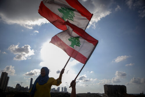
Photo by JOSEPH EID/AFP via Getty Images
The Middle East Institute (MEI) is an independent, non-partisan, not-for-profit, educational organization. It does not engage in advocacy and its scholars’ opinions are their own. MEI welcomes financial donations, but retains sole editorial control over its work and its publications reflect only the authors’ views. For a listing of MEI donors, please click here.